National Tidal And Sea Level Facility on:
[Wikipedia]
[Google]
[Amazon]
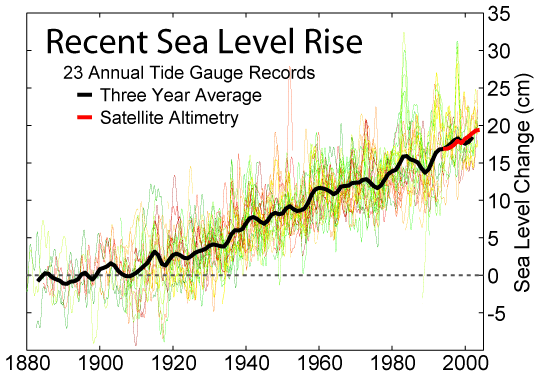
 Established in 2002, the National Tidal and Sea Level Facility is responsible for monitoring sea levels in the UK.
The NTSLF comprises the UK National Tide Gauge Network,
National Tidal & Sea Level Facility Official Website
Natural Environment Research Council Website
{{authority control 2002 establishments in the United Kingdom Natural Environment Research Council Oceanographic organizations Organizations established in 2002 Research institutes in Merseyside Sea level University of Liverpool
 Established in 2002, the National Tidal and Sea Level Facility is responsible for monitoring sea levels in the UK.
The NTSLF comprises the UK National Tide Gauge Network,
 geodetic
Geodesy ( ) is the Earth science of accurately measuring and understanding Earth's figure (geometric shape and size), orientation in space, and gravity. The field also incorporates studies of how these properties change over time and equivale ...
networks, and gauges in the British dependent territories of the South Atlantic and Gibraltar
)
, anthem = " God Save the King"
, song = " Gibraltar Anthem"
, image_map = Gibraltar location in Europe.svg
, map_alt = Location of Gibraltar in Europe
, map_caption = United Kingdom shown in pale green
, mapsize =
, image_map2 = Gib ...
. Data collected is used to create tidal predictions, monitor climate change
In common usage, climate change describes global warming—the ongoing increase in global average temperature—and its effects on Earth's climate system. Climate change in a broader sense also includes previous long-term changes to ...
and determine extreme sea levels for navigation and coastal engineering design.
The network is funded by the UK Environment Agency. Associated scientific research is funded by the Natural Environment Research Council
The Natural Environment Research Council (NERC) is a British research council that supports research, training and knowledge transfer activities in the environmental sciences.
History
NERC began in 1965 when several environmental (mainly geog ...
(NERC) and the Department for Environment, Food and Rural Affairs (Defra).
External links
National Tidal & Sea Level Facility Official Website
Natural Environment Research Council Website
{{authority control 2002 establishments in the United Kingdom Natural Environment Research Council Oceanographic organizations Organizations established in 2002 Research institutes in Merseyside Sea level University of Liverpool